


TRADERS Talk web-platform is an extension of the TRADERS project, which seeks to engage art and design practitioners and researchers in critical reflection on participatory art and design in/for public space.
Read more


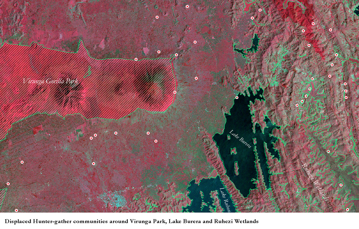
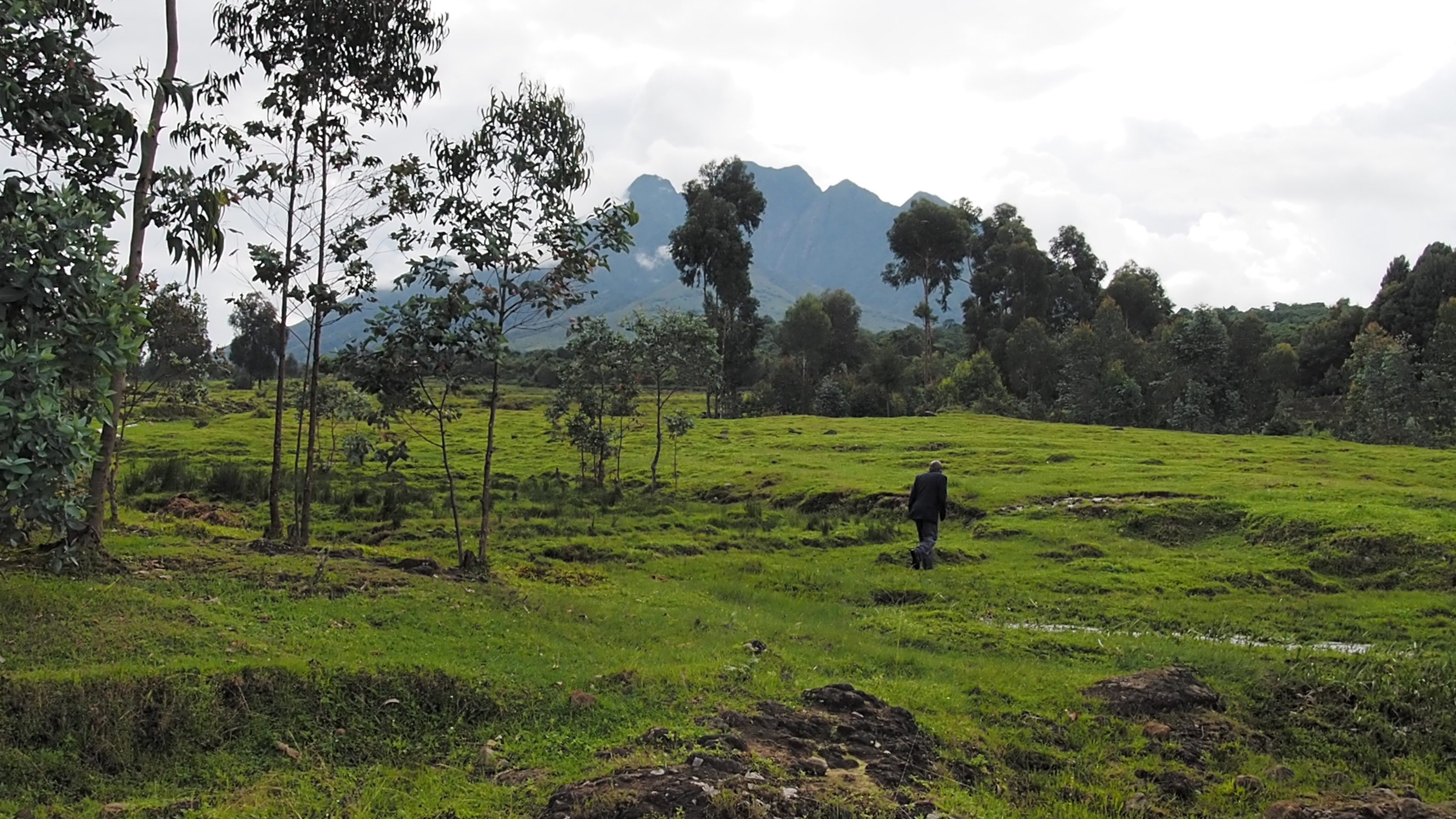
The forest, lakes and wetlands that lie across the Great Lakes of Eastern Congo, Northern Rwanda and Southern Uganda are the dwelling space for tens of thousands of hunter-gatherer communities, yet many of these spaces have been reclaimed and appropriated by the state as sites of natural resources. Such resources are exploited through economic ‘development’ programs promoting industries of tourism, extraction and energy over the physical and spiritual well being of hunter-gatherers. As hunter-gather ancestral lands are re-territorialized, livelihoods, cultural and social relations are often dissolved; today these communities have some of the worst socio-economic conditions across East Africa.
Displaced hunter-gather communities often re-build transit shelters close to the edges of former lands, permitting intermittent access to resources albeit illegitimately. Shelters are built in a manner familiar to these communities – seemingly temporary and from freely sourced materials of clay, grass and wood. These dwellings are often targeted by the state (as ‘primitive’) and destroyed, with communities today forced to live and re-integrate via government approved ‘modern’ dwellings, yet without equal rights to land (to farm), employment and education.
This project is the first part of a long-term research question to explore the notion of ‘dwelling’ from the hunter-gatherer perspective, towards challenging definitions of what ‘development’, as a mutation of modernity, can mean and often does. This research hopes to destabilize and disempower such broad, totalizing definitions that drive practices of ‘development’ and to redefine and reconstitute these terms in a manner in which non-western communities concerns are heard.
This project works with displaced hunter-gather communities and human rights groups between Rwanda and Uganda.
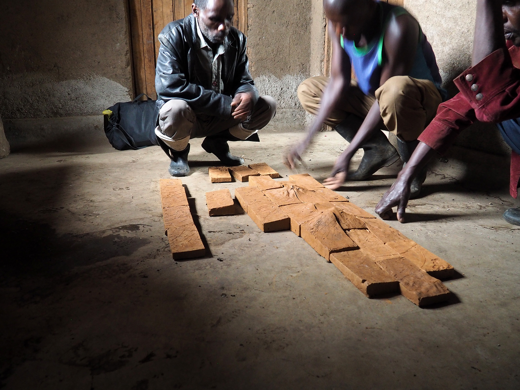
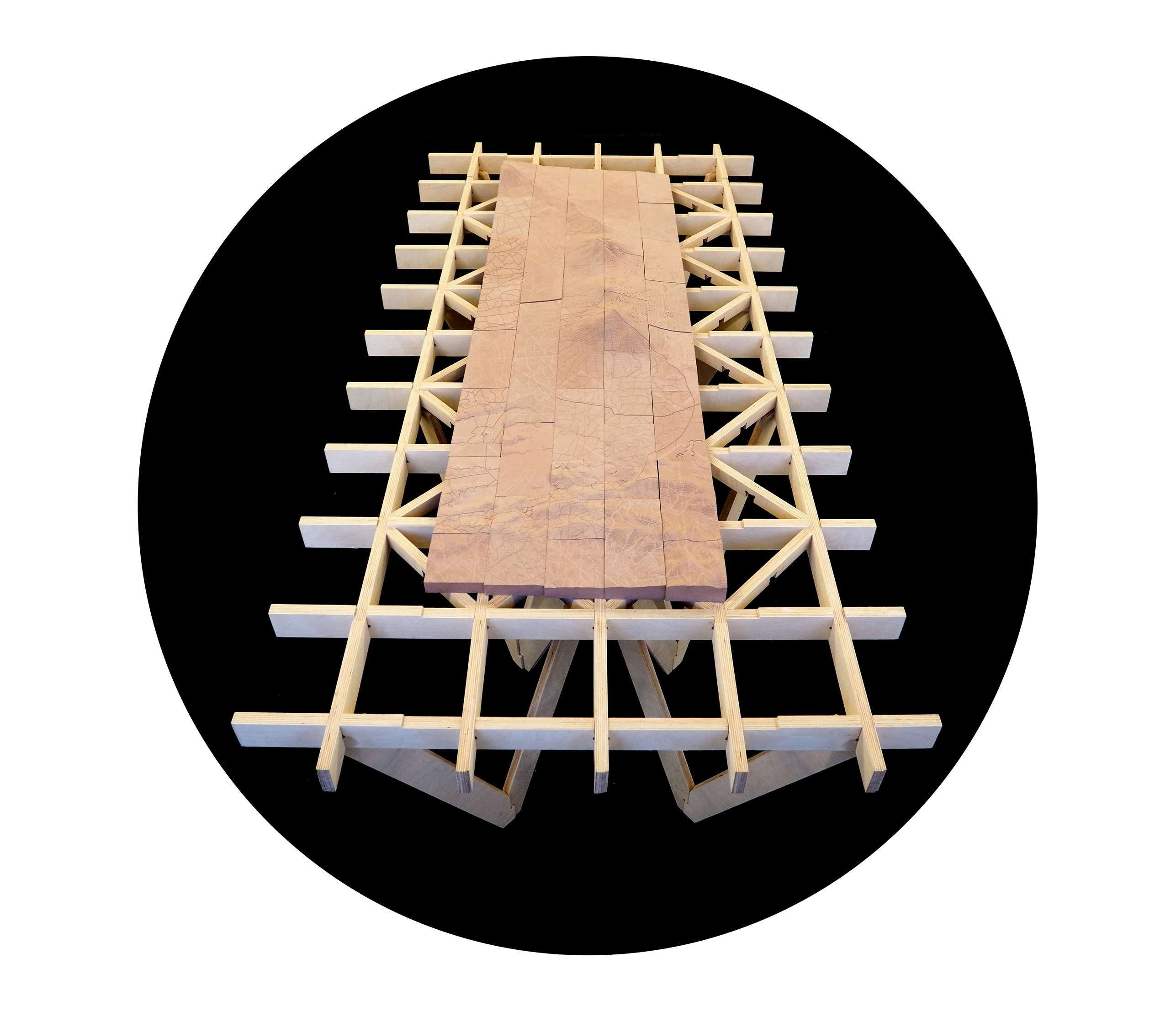
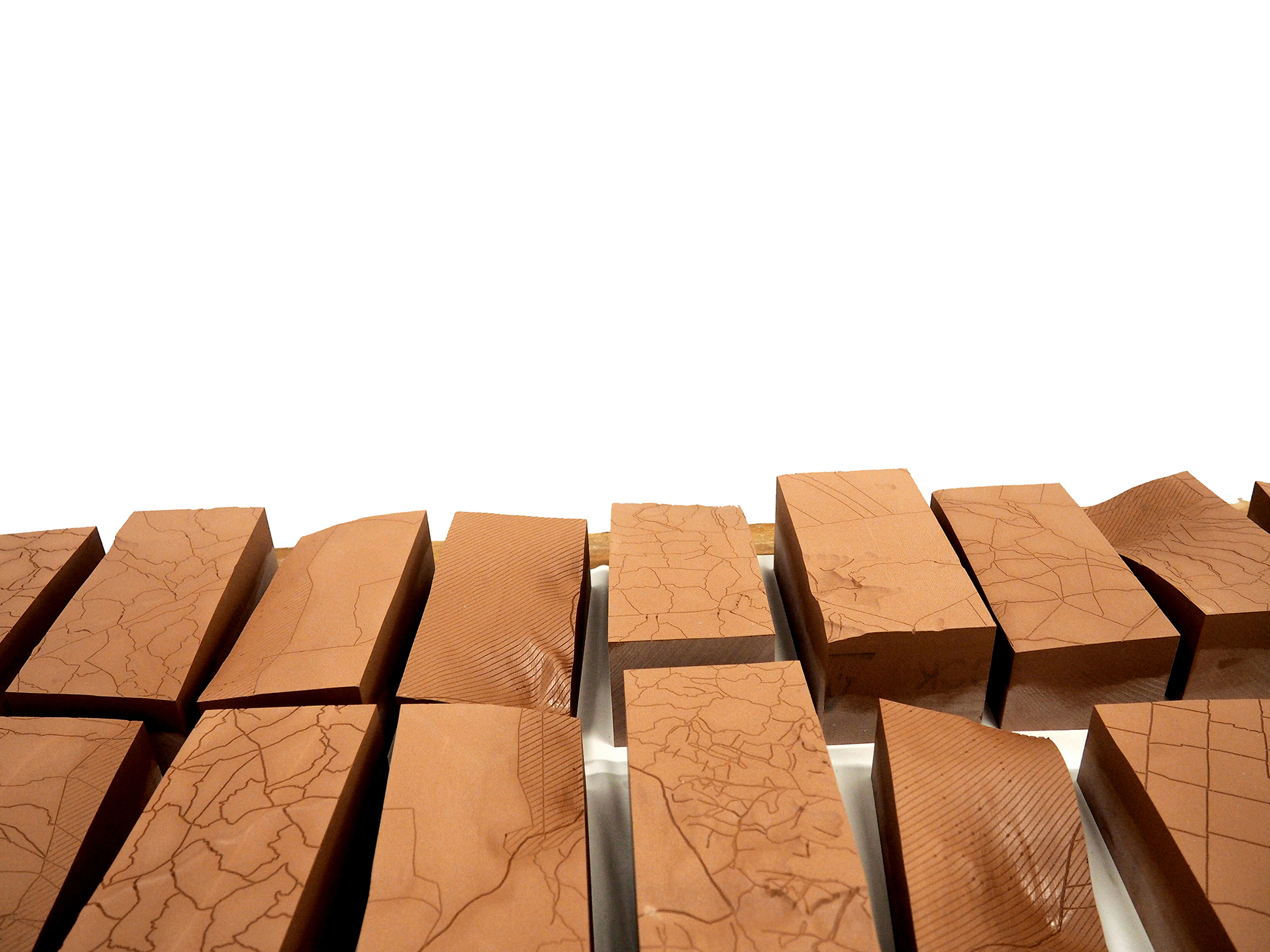
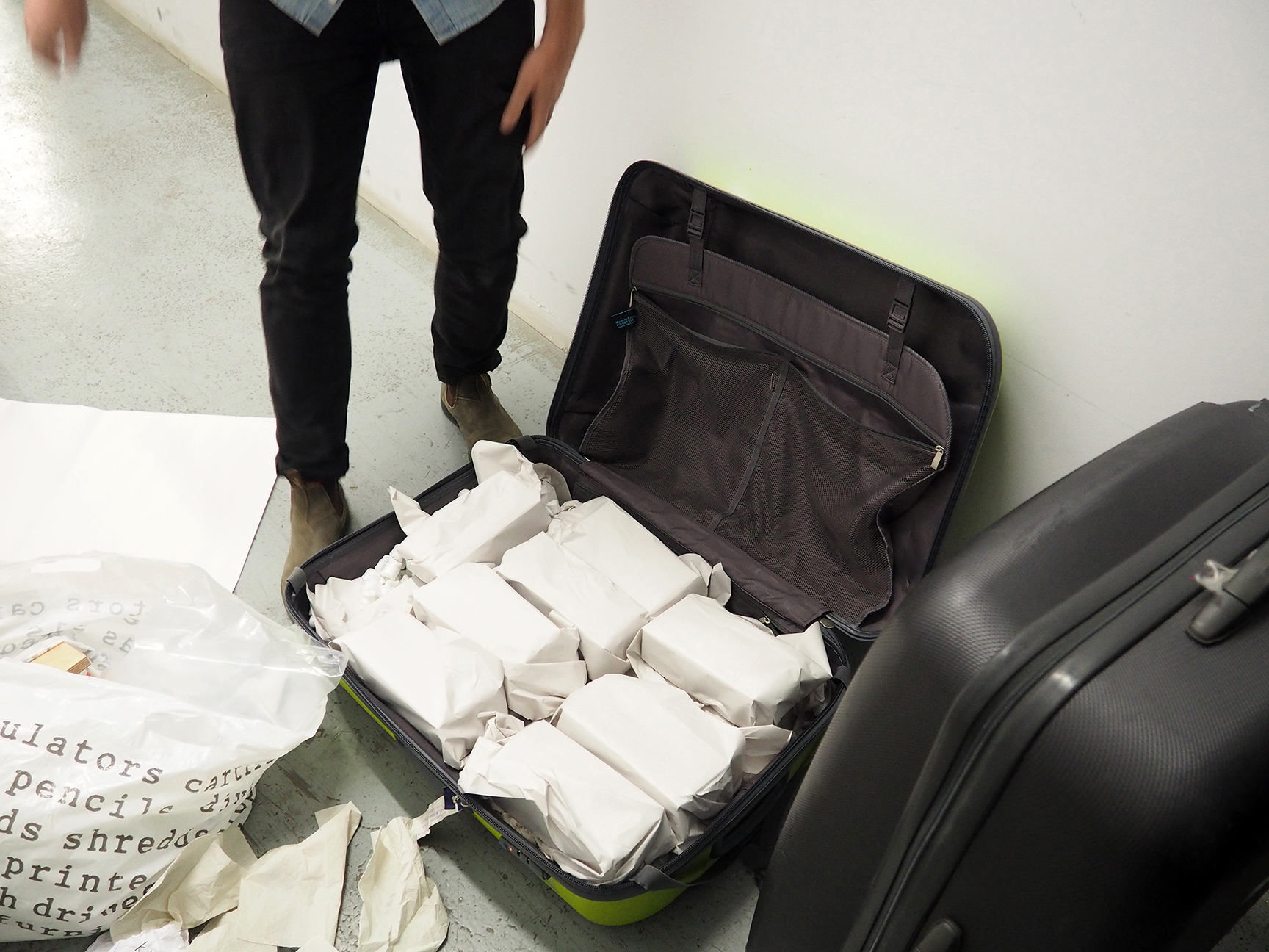
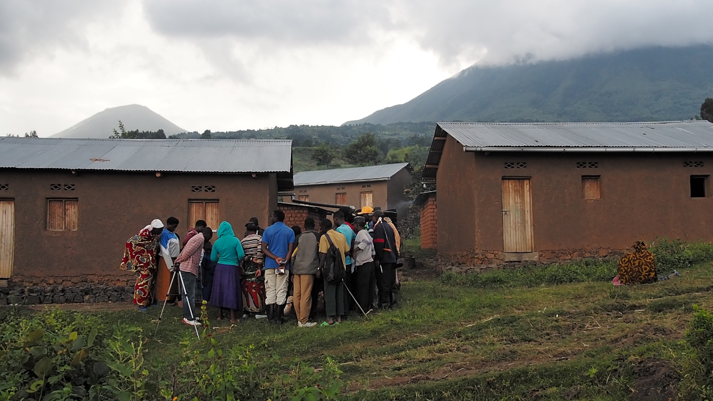
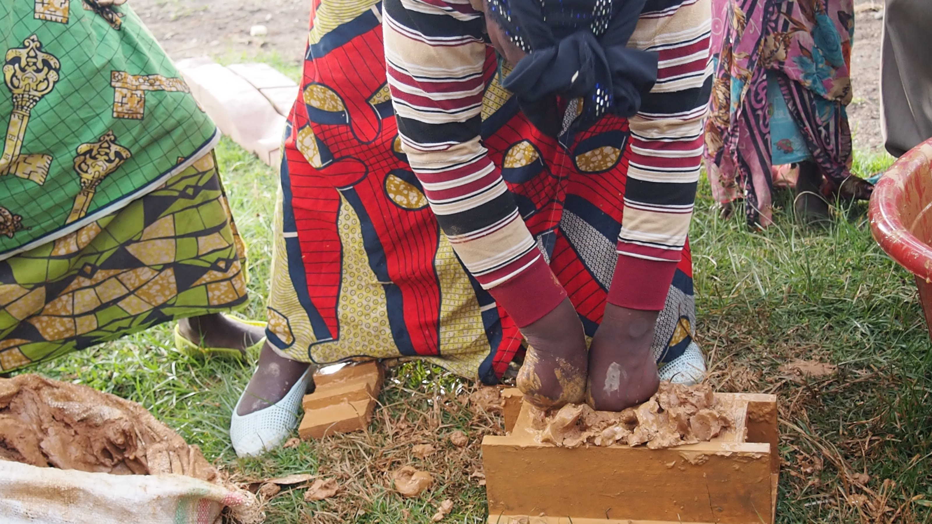
The first part of this research (the reconstituting) takes the basis of what is called ‘participatory rural appraisal’; a group action where sites of value in the surrounding area are recalled through memory, mapped and discussed. The map in this case takes the form of a large-scale 3d model of communities’ former ancestral lands made on site from parts constructed and transported from the UK.
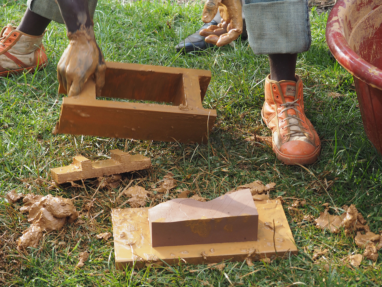
This mobile model as map has been designed, fabricated and reduced to fit within the weight and dimension restrictions of airplane luggage (i.e. within a suitcase under 20kg); in negative form of molds so that it can be re-made and repeated by the community; and in a module and technology that is familiar and affordable to local communities -the scale of a local brick, made from clay and water.
The activity of mapping cultural values begins to question state claims to common landscapes of forests, lakes and wetlands as economic resources, whilst giving light to former hunter-gatherer practices, beliefs and resources that could drive new activities and forms for a multi-scalar landscape to settlement design strategy. In addition this cultural mapping connects and overlaps with on-going international land-advocacy projects for hunter-gatherers that make legal claims to land lost as a consequence of modernization and ‘development’.
The design and acting out of this event is part of a broader critique of how ’development’ processes prioritize western over non-western knowledge that can have the sum-effect of rendering community participants as passive observers, bringing discussion to how power and knowledge relate to structural inequality.
Over a 10 day period this model was re-made onsite and mapped by a small displaced community in Rwanda.
Thank you for contributing your project, Killian; I find it very context-sensitive, both in the process and its outcomes. There is also great care for the means in which the communities can represent the(ir) space; it makes explicit the political and cultural level of the project. I would like to understand further, though, the relation between the process of fabricating the bricks, the collective mapping activity and the (more visual) maps that you share. What role does each play in this process?
Hi Pablo, Thanks for the comments.
The bricks are made using 3d fabrication technology abroad. The decision to make them abroad allows the modelling and fabrication technology to accurately model the landscape from contour data, etch all the government boundaries onto then enables it to be reversed and fabricated into negative moulds. Once transported to site the model is remade onsite using traditional brick making techniques that are familiar to the community as well as using clay that is sourced nearby.
The model is a 3-dimensional version of the map as not all groups can understand and/or read maps, and so making it as a model allows a greater understanding of their physical position within the landscape. But before mapping , the groups have to re-fabricate it and re-assemble it. This responsibility is done to engender ownership of the process, the discussion and the model itself by the community – something overlooked in the processes and practices of ‘development’ that often make the people simply passive observers.
The model as a brick is easily transportable and allows refabrication. But it’s use is also a specific reference to the communities denied role of having a decision in where they now live and simply taking part in the construction process (i.e the brick making and construction they know how to do, but a task given over to private contractors) and broadly a comment on the industrialization of material practices that use clay in Rwanda (artisinal informal access to such practices are becoming forbidden).
The information that is ‘mapped’ onto the model goes back into a set of drawings to make clearer the affects of hunter-gather communities forced re-integration i.e conflict of land use, dispossession and seasonality. This information goes towards maps for land advocacy efforts locally but will also be used as propositional design tool for interventions. Please let me know if you have any more questions!